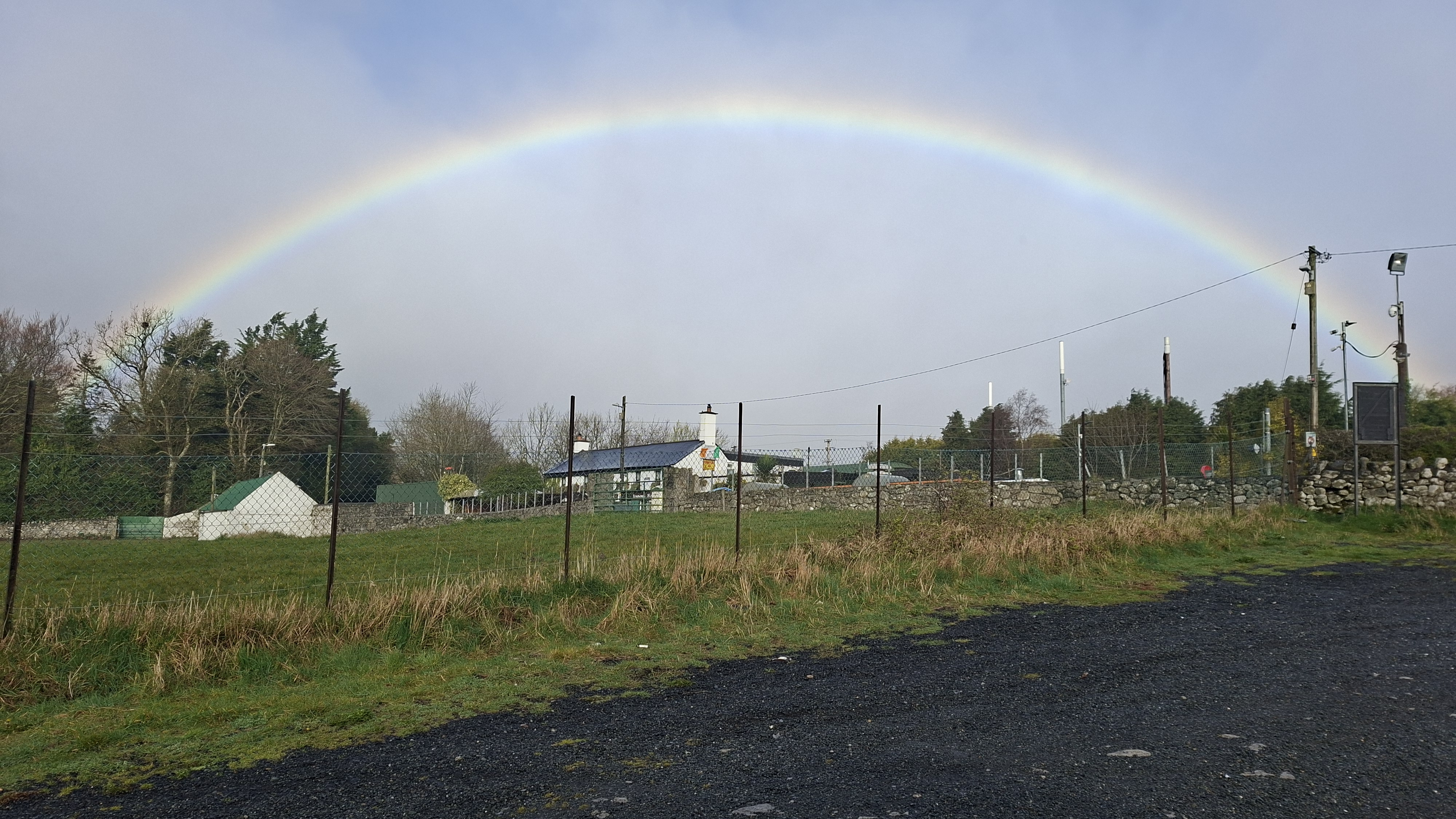


I woke to some rain this morning, but there was also sun, which brightened the day, and when I got out the van there was a beautiful rainbow arched over the pub. As I set off my coolant alarm went off so had to top that up. It was quite windy this morning, which caused a lot of my stuff to blow around the van as I opened up the back to grab the coolant.
I’d decided to make my way to Glendalough, I can’t remember why, I think I looked at the map and saw a lake, googled it and it said good lake walks. It was also in the direction I wanted to head, towards Cork.
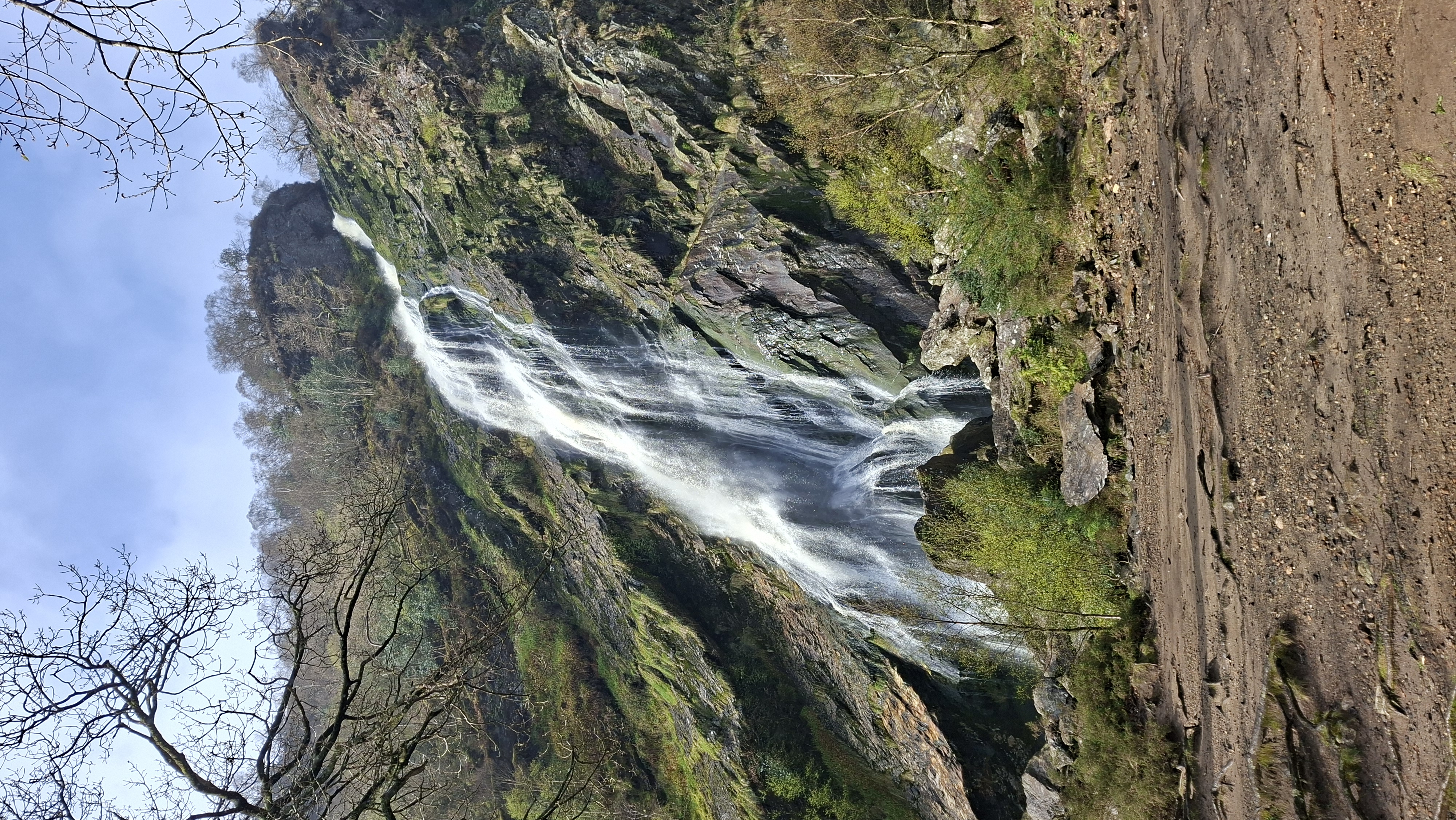
Enroute to Glendalough I was on lots of country roads, up and down hill. There seem to be lots of signs here for touristy spots, and I saw one for Powerscourt waterfall. Ever a sucker for a waterfall I turned off track to follow these signs. This is why I didn’t want to make too many plans set in stone, to allow for deviations like this. Powerscourt is near Enniskerry, which is a cute little village itself, lots of cyclists when I passed through. As I was heading toward the waterfall it was still raining, misty rain, and the sun was shining,.. another rainbow. Gosh its annoying when you’re the driver and you want to look at stuff out the window. I do try my best to look around me because there is so much to see and miss if you’re not careful. Right, I need to pull over. Tried to find a spot where I could pull in but also have a good view of the rainbow. It turned out to be a perfect spot!
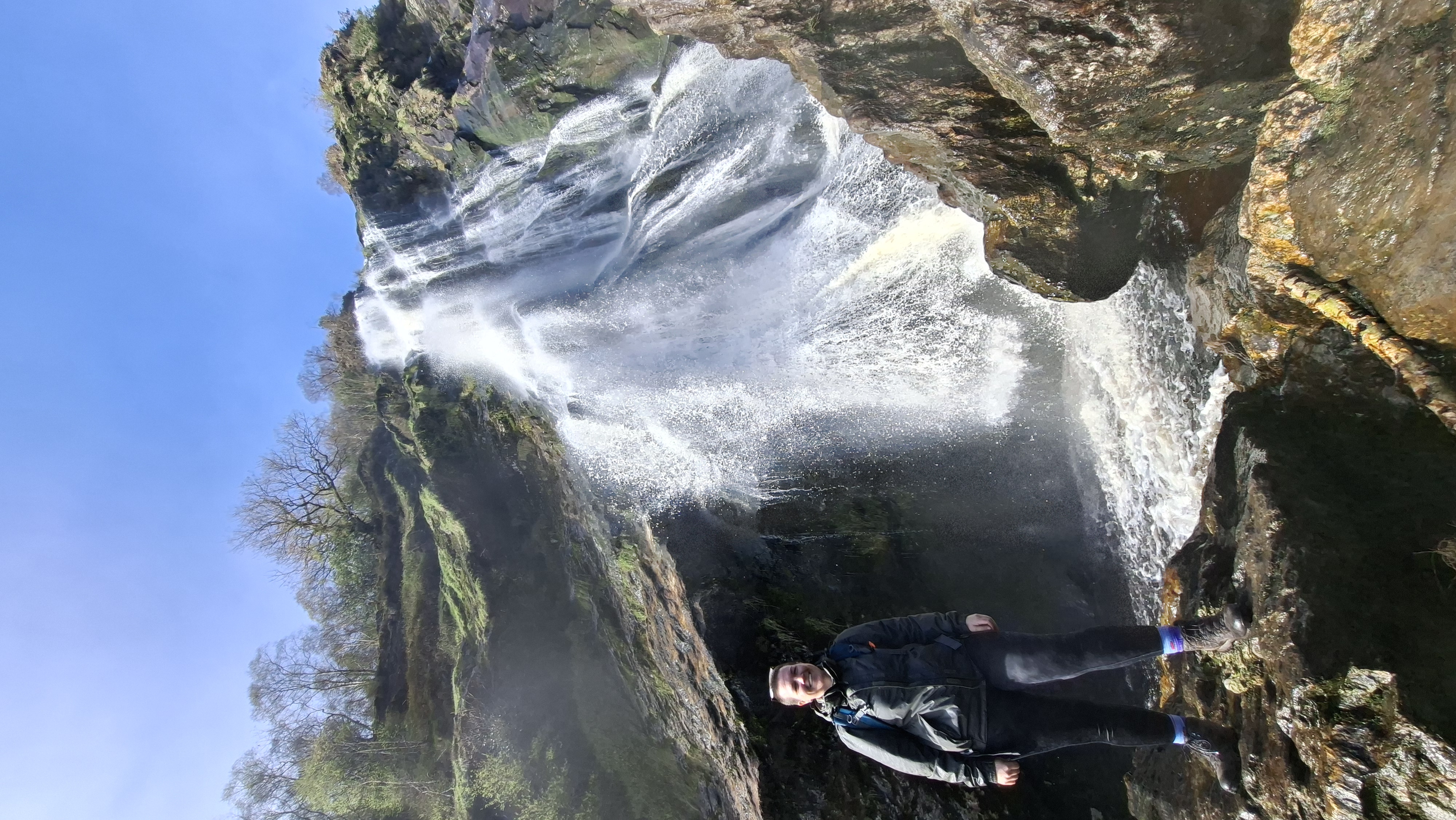
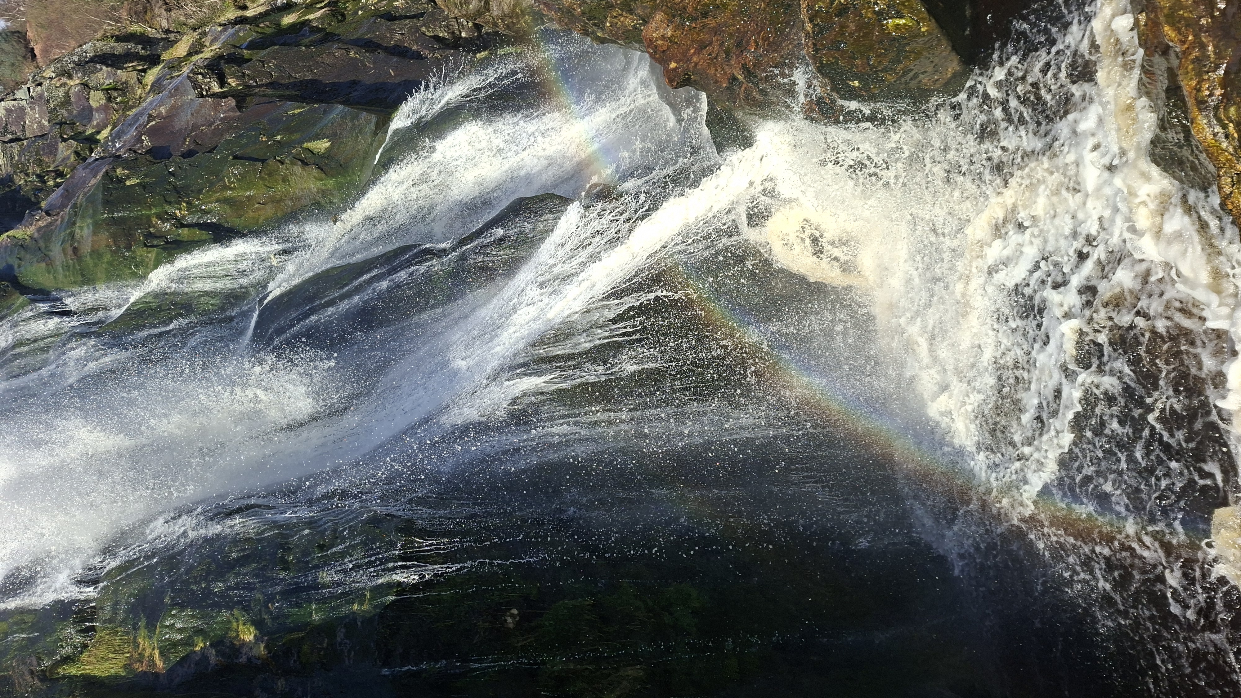
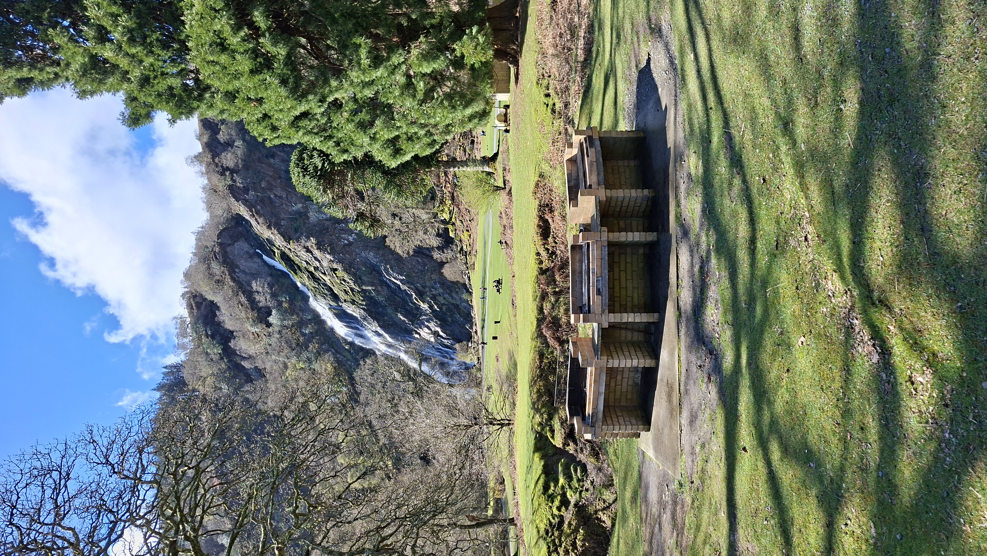
When I got to Powerscourt it wasn’t very busy, a few tourists. I made my way out of the carpark and could see the waterfall straight away, it was barely a 5-minute walk away, and it was amazing. Apparently, the tallest waterfall in Ireland at 121 metres high. The setting really enhanced it, coming down the hill from the carpark, an expanse of grass and brilliantly tall trees dotted around, but clear enough to show off the impending waterfall. I approached its awesome height and clambered to get nearer. There were some big boulders to navigate, which helped and a very kind lady offered to take my photo. It was very refreshing in the spray.
There were also lots of built in BBQ units, It must get really busy here in good weather, and to deter disposable BBQs they have built brick ones. As I was leaving one was actually being used. I couldn’t make out if it was an organised event like a community gathering, or whether someone had just decided to cook up some food and hand it out to anyone. The people queueing up didn’t especially look like they knew each other.
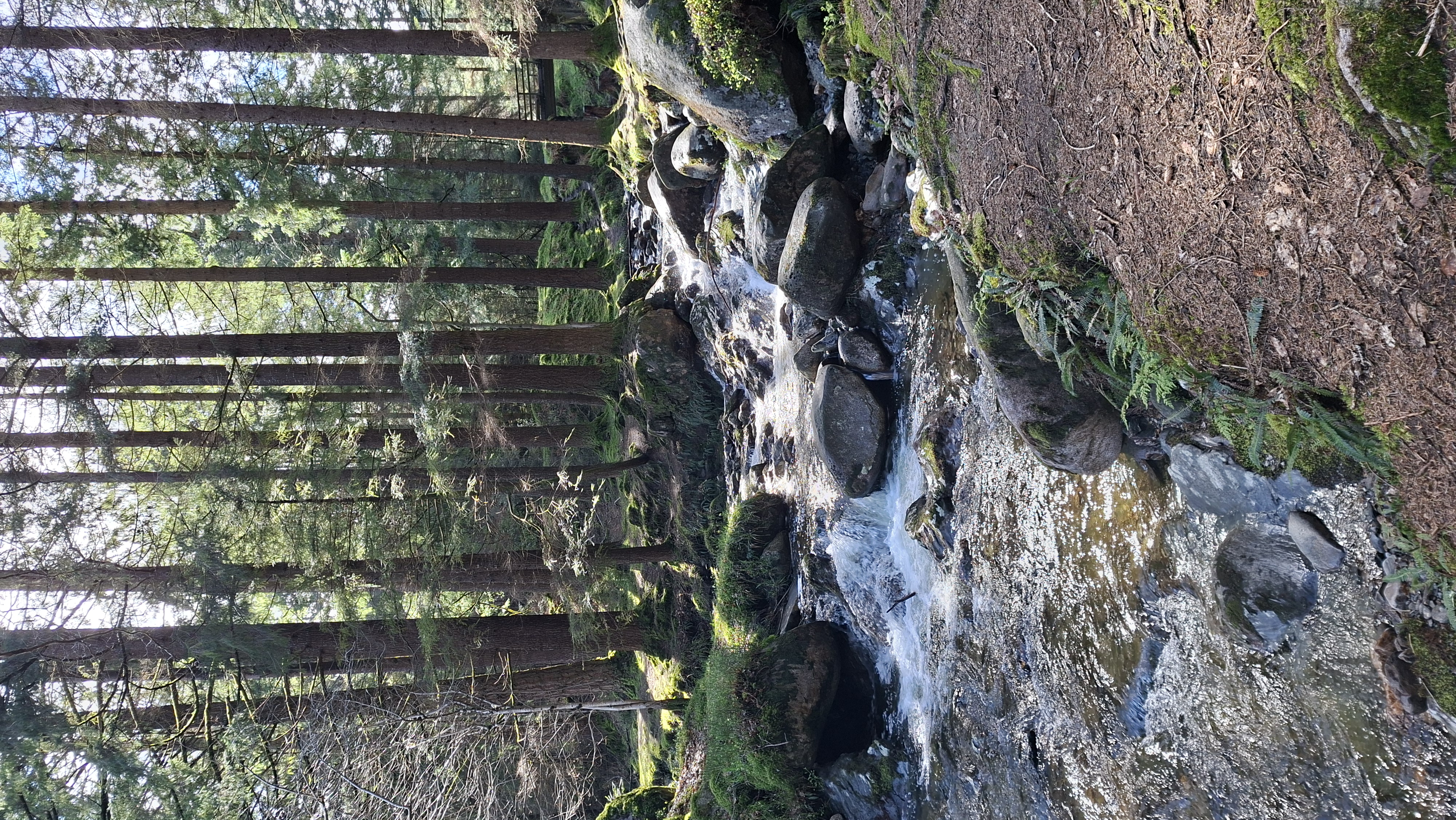
The Powerscourt estate seems fairly large, and I didn’t explore even half of it. There are some neater landscaped areas of trees, but also some pine forests, but tracks throughout. It’s a popular place, as when I returned from my walk the waterfall area was heaving, which is when I realised Ireland is a very popular place with lots of nationalities.
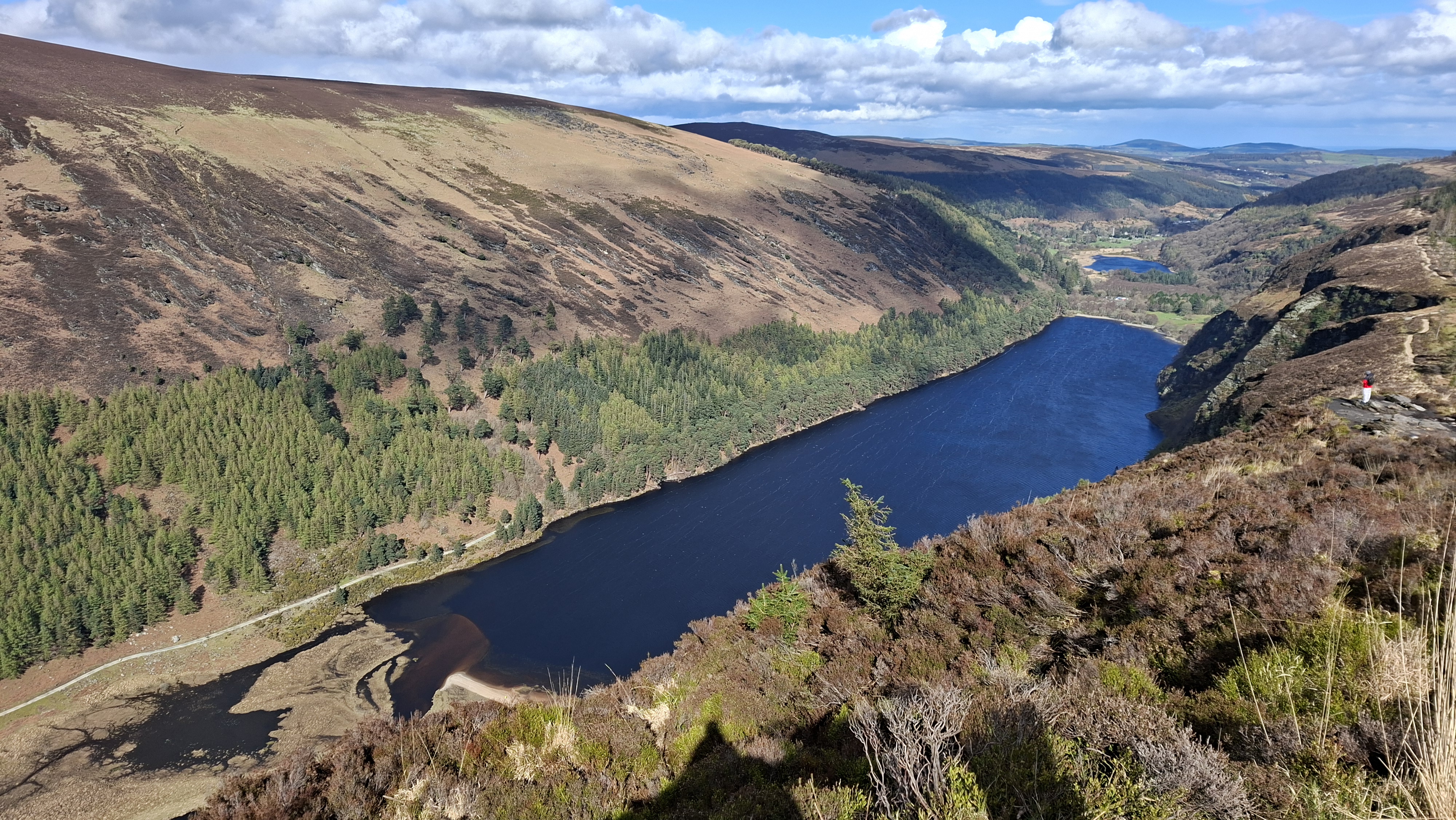
After some lunch I decided I’d best continue onto Glendalough. I arrived late lunchtime and it was quite busy, coach loads of tourists, and no sign of on street parking. There are no streets lol. Its all very rural in these parks, and you have to pay in the large car parks provided. I try not to stop in carparks if I can help it, as this eats into my budget, but 5 Euros didn’t seem too bad for the day. My OS maps on my phone doesn’t work in Ireland, so I’m relying on my google maps to see what’s around, but this doesn’t help a huge amount in the rural areas, with paths etc. OS maps is fab for that. On the google maps it showed a path all around the Upper Lake at Glendalough, so I decided to follow this. It was still on/off sun and misty rain, but it didn’t look like the rain would stop when it did appear. The path lead up into forests, which are maintained by several organisations, with a cycle of regeneration to maintain the tree growth. Once I was on the top of the hillside it opened up to rock and gorse, with fantastic views over the lake. The cloud cover was high, and the risk of rain had blown over. The walk along the top was a light relief from the ascent, but as I neared the end of the lake it started to incline again, with rough rock steps, this then turned into thick boards lain down for walkers to avoid the bogs. I thought I’d already reached the top, but obviously not! Eventually I made it to the summit, and I knew as soon as I got there I would feel pleasure in the easy road ahead that I could now enjoy. This route took me to the end of the valley where the river began, which ran into the lake, then doubled back on itself back along the other side of the lake. I passed the old mining area where they used to mine lead, which used to be very busy with multiple stages of the lead extraction process taking place up here, involving men, women and children. The track finally lead back to the car park along a road.
A thoroughly enjoyable day, taking in several waterfalls and rainbows, and providing a good amount of walking.