

Today I had planned to head towards Skibereen and Bantry. I’d been told both were nice fishing villages, so wasn’t sure which one to go with. Skibereen was nearer so targeted that first. I wasn’t sure much would be open, being bank holiday, but who knows what I was to see. I had also looked up some bike rides and walks near Bantry on the Outdooractive app if I needed some back up ideas.
In Skibbereen I managed to find road side parking and saw the sign for the public loo so headed in search of it. Found one of those big black freestanding tardis loos, and noticed it had a radar key slot. I’d bought a radar key on the recommendation of another vanlifer online. It worked! I was well chuffed to have been able to use it, and save 25p lol. I had a quick look around, nothing was open except the supermarket and the café connected to it, and I didn’t really want to spend my time in a café so early in my day. So I made my way back to the van and set off towards Bantry.
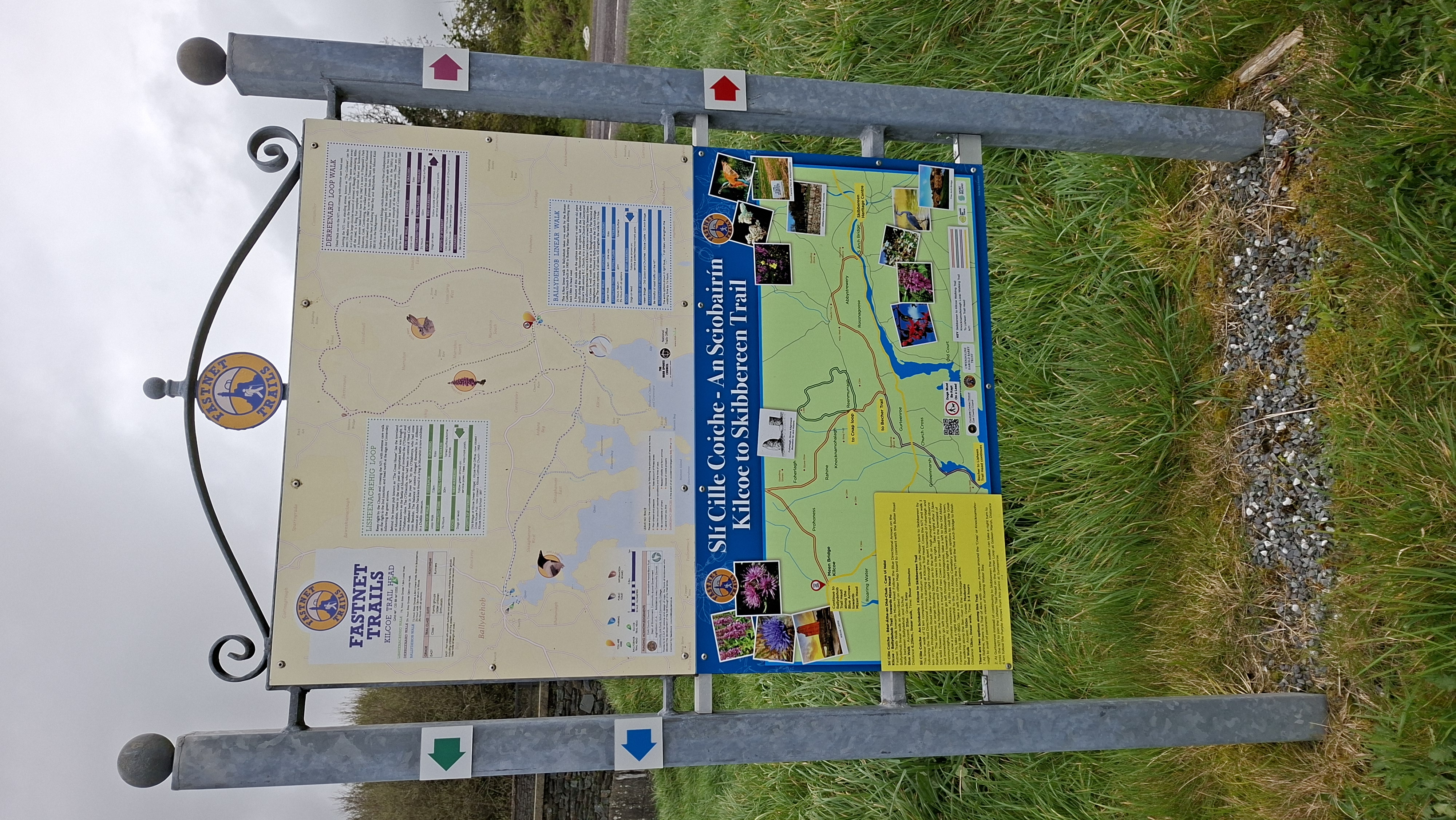
As I left Skibbereen the views opened up to see the coast and I wondered if I could stop somewhere along the route to see the rugged beauty of the sea and coastline. I’d clocked a place called Roaringwater Bay, so thought that had to be just the ticket. Before I could get there I spotted a layby with a good viewpoint so stopped to take a photo. In the layby was a plinth giving information on walks in the local area called the Fastnet Trails, so I looked these up on my phone and saw a couple of loops and a linear one that went past Roaringwater Bay and onto a place called Ballydehob. Now I liked that name too, and with it only being 6.5km, so 13km with me having to come back, it sounded like a good option.
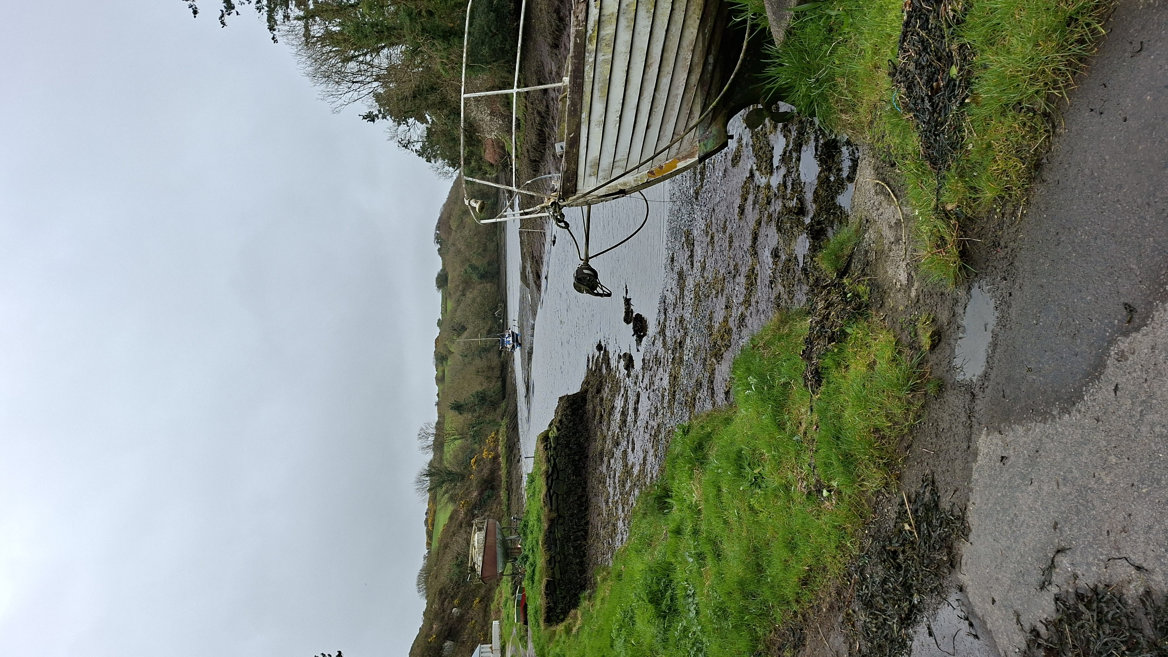
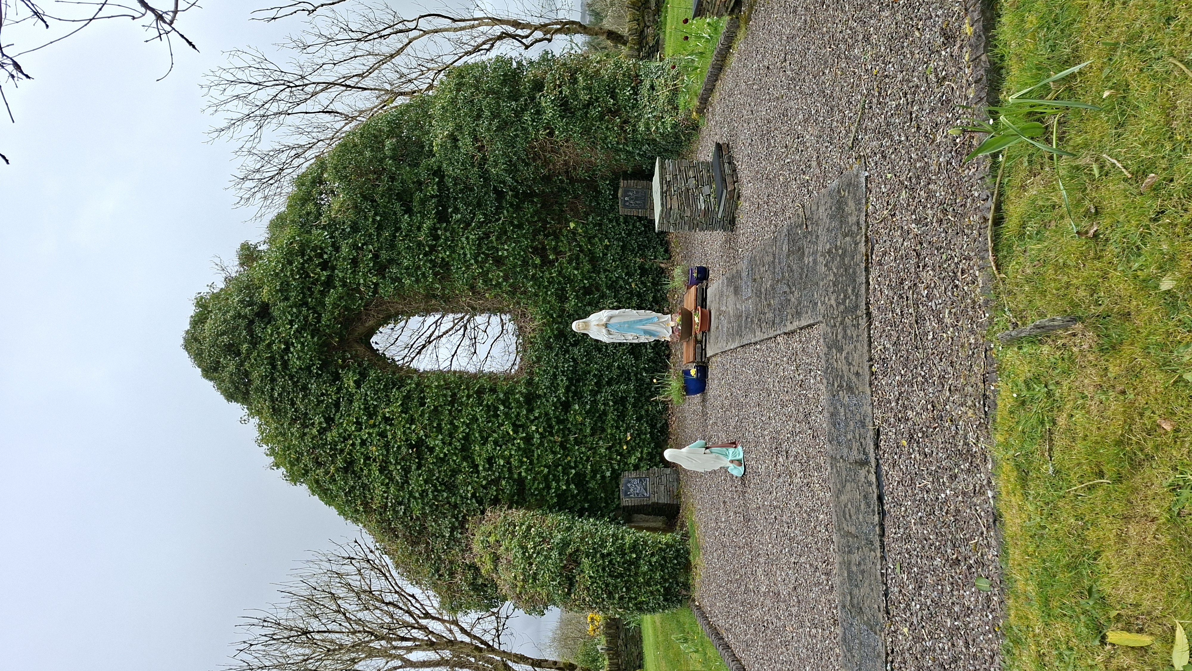
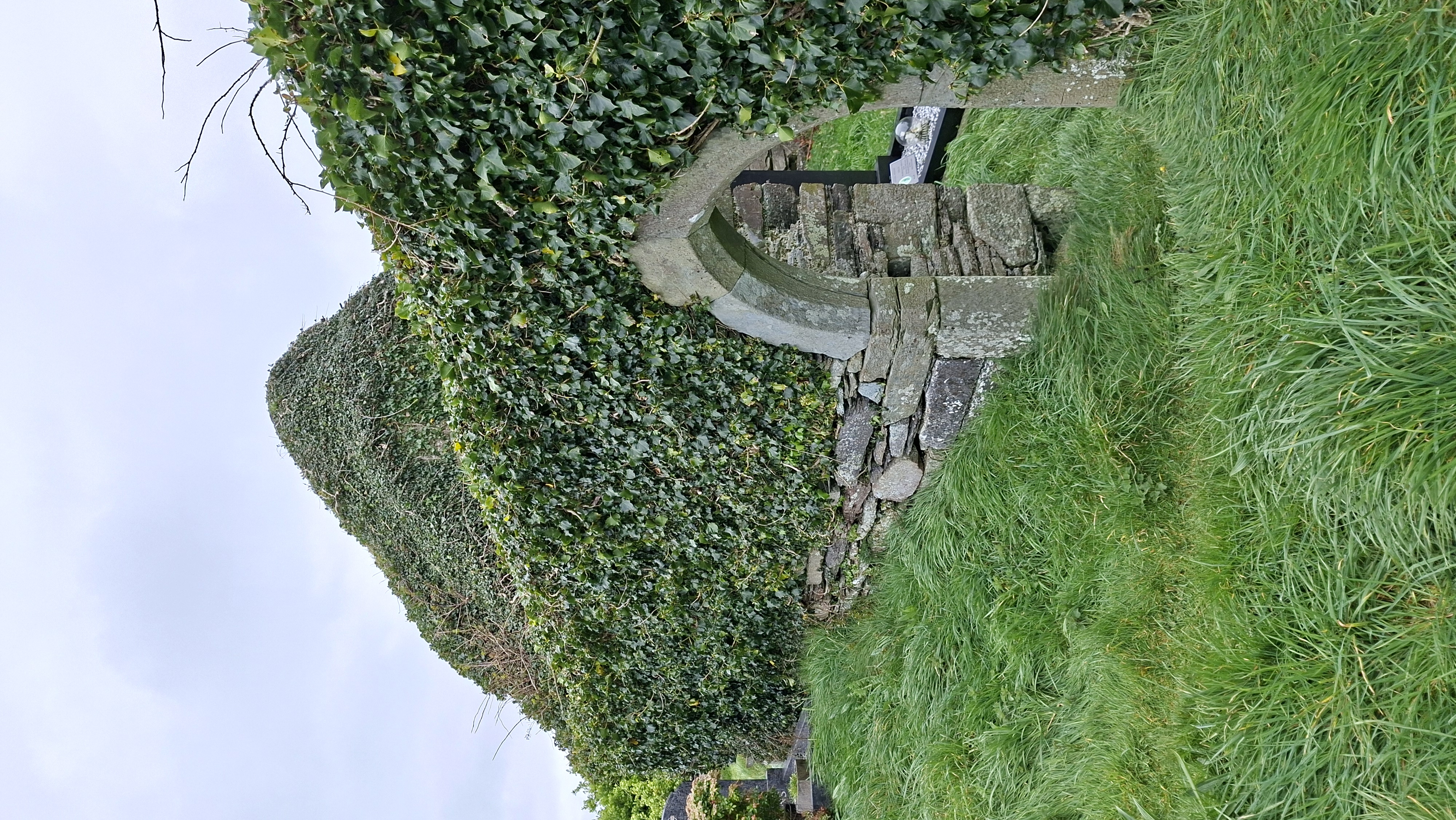
The parking area at the start of the trail seemed to be free, so another good point. It started on a long road following a rocky river, leading down towards the coast, passing a ship yard, which looked a bit sorry for itself, then on towards Roaringwater harbour. It was a tiny harbour, but quaint, with a wild feel to it. Most of Ireland has that feel though, nothing seems polished, which is the charm it holds. The path lead up towards the ruin of an 18th century church which used to be used by the village and workers of the mills that were once prevalent in this area. The main church wall, with the cutout where the window would be, is a bold statement covered in ivy and other creepers, and provides the main focus of what is now a prayer garden. I continue along country roads, passing the odd house, then a deviation on a couple of km went down towards an old church, which they think dates back to 15th century. I’ve found that a lot of the Irish information is quite vague. They generally say something like ‘legend says’, ‘in the folk stories’, Its been said that..’, ‘Nobody’s sure, but..’. It was like that at Blarney Castle too. I just didn’t think it sounded very ‘professional’ to providing information that wasn’t confident in its legitimacy. Although I guess at least they were being honest. It just seems that attractions in England tend to have more research, which has been proven, but then maybe our history is better preserved. The church was again very bold and sturdy in its general structure being covered in ivy. The grounds were very lumpy, but littered with graves that were all recent, within the last 100 years. Apparently, people still request to be buried here, and there seemed to be many family plots. It was a very raw spot, on the coast. All round here gives off Daphne De Maurer vibes, of dramatic seas and melancholy stories.
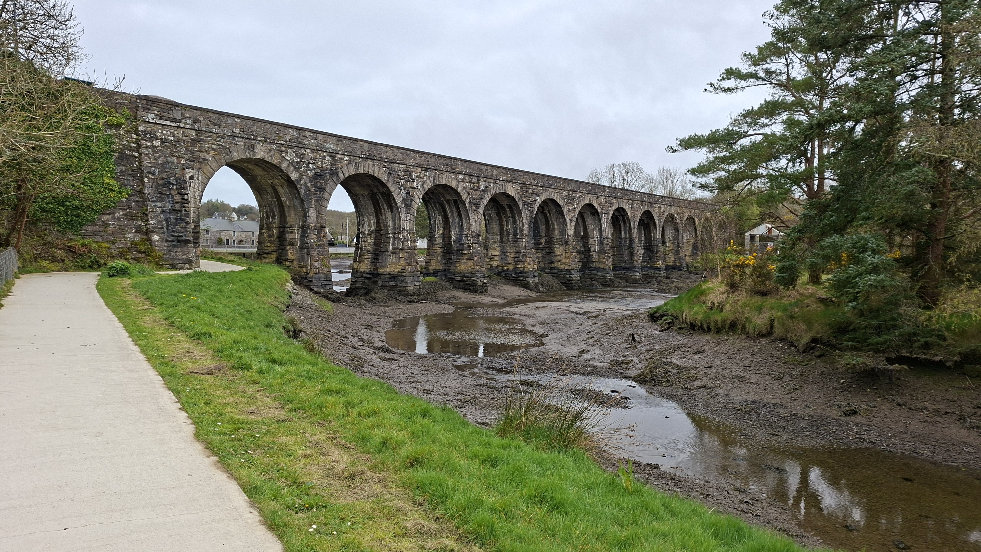
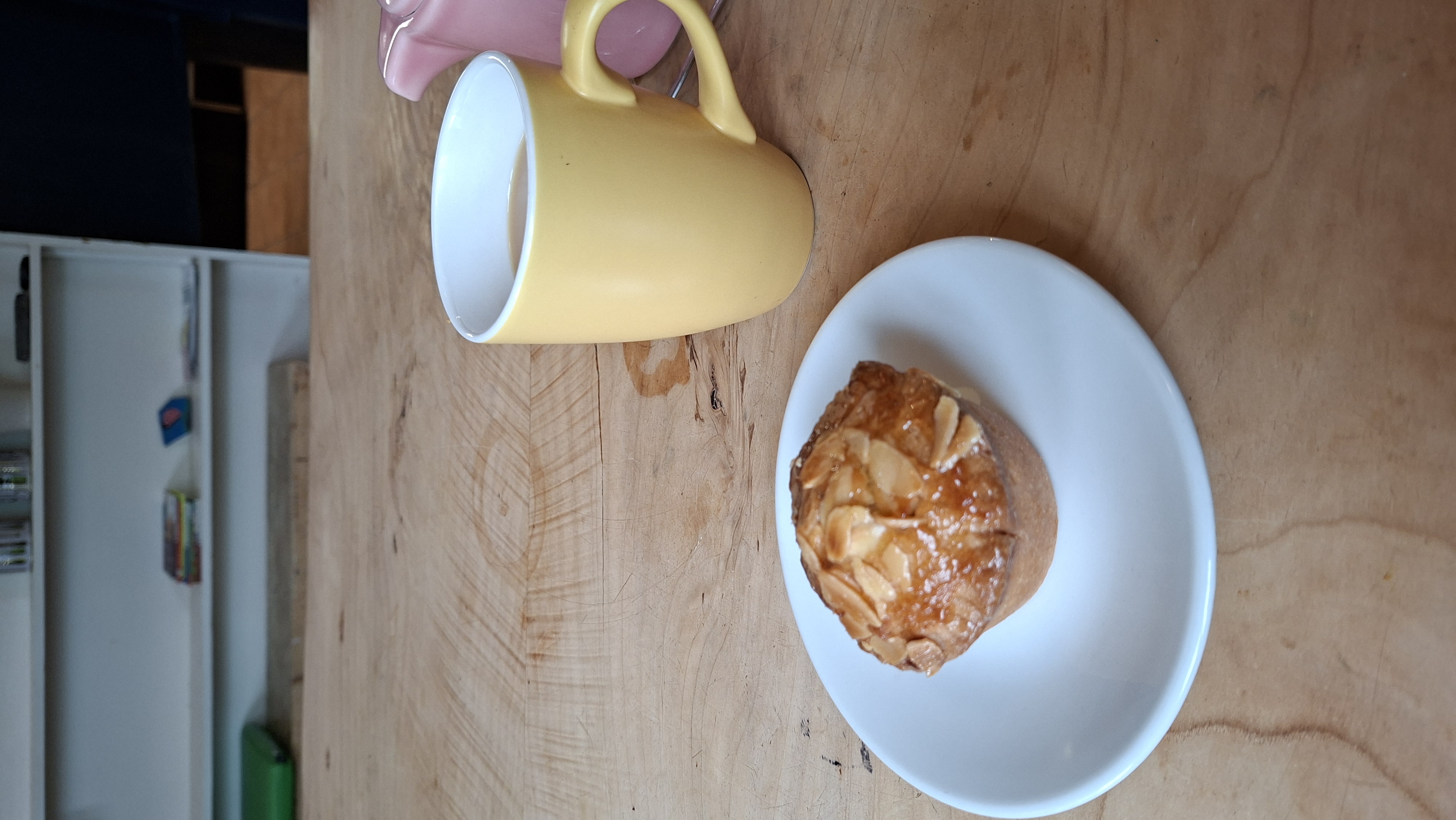
The Road was a long straight was after this point, at one point passing over a bridge where it was said you may see a king fisher is you kept quiet. I sat perched on the stone bridge wall, eating my cream egg, and sipping on my flask of tea, in the hope of seeing one. No such look, but a beautiful spot none the less. The road continued all the way into Ballydehob, having to walk on a busy main road at one point (didn’t think that was very responsible of the creators of the walk). On entering Ballydehob (wont tire of saying that name) I passed under the 12 arched railway bridge before finding a café to use the loo, and have a cuppa and a cheery bakewell.
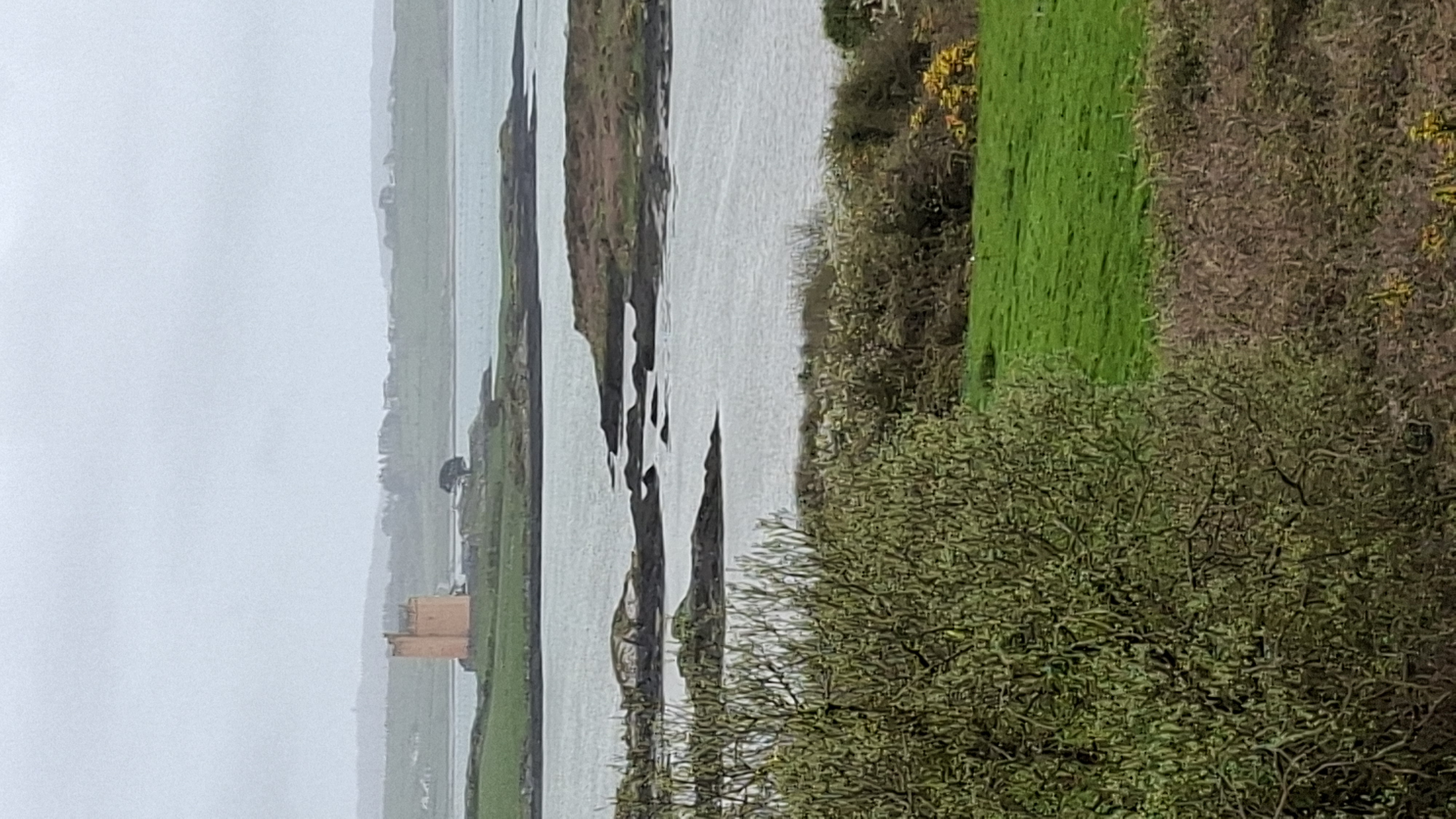
The route back was obviously the same, except for a deviation off to the coast again where you could see the distant figure of Kilcoe Castle, a striking yellow tower, apparently owned by Jeremy Irons.
The weather had been pretty good to me today. It tends to start off wet and drizzly in the morning, for the cloud to lift by lunchtime. Although not dispersed, the cloud was high enough not to rain on me. It was a late finish, as it had been a late start to the walk, and I made my way on a longish drive to the next britstop of Molly Gallivans Visitor Centre, perched in the hills just over the border of County Kerry.